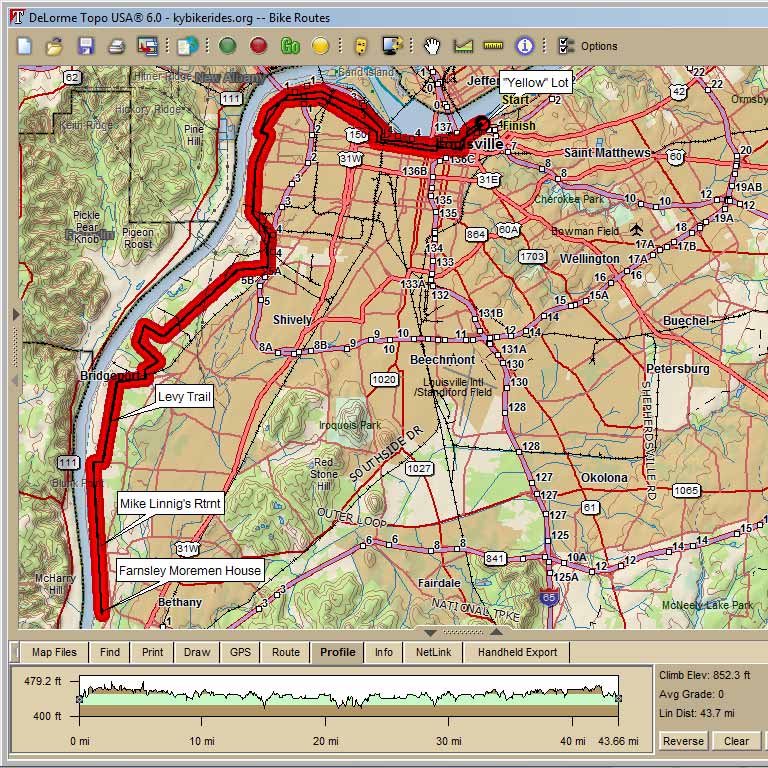
4250 Yellow Lot to Farnsley-Moremen House -Lunch@Subway 46.7 mi Cumulative Climb: 852’ Avg: 18 ft/mile RC: Murphy
Mile
Turn
Street
R
River Road
0.4
L
Witherspoon Way
0.7
Clay Street
0.9
Main Street
2.8
15th Street
3.1
Portland Avenue
4.8
BL
Northwestern Pkwy.
6.7
Southwestern Pkwy.
6.9
7.2
Into Shawnee Park at River Park Dr.
Exit at Broadway(mile 8.1)
8.1
X
Broadway and rejoin path on
10.2
Onto 41st St. PU path on L side
of 41st. !!41st NOT MARKED!!
10.4
Bells Lane !CAUTION!
CROSS TRAFFIC DOES NOT STOP!
11
BR
Campground Road
14.1
Lees Lane
14.6
Levee Trail WATCH FOR GRAVEL
15.1
On Levee Trail
23.2
Turnaround at Farnsley-Moremen House lot
23.4
Onto Levee Trail
25.9
Onto road off Levee Trail
Cane Run Road
26.5
Global Drive
27
at Marathon Station
SUBWAY on R
27.1
Out of SUBWAY onto Global Drive
27.6
28.1
Greenwood Road
IMMEDIATE R to rejoin Levee Trail
32.6
Exit Levee Trail R onto Lees Lane
33.1
36.3
Rejoin bike path on L side of street
36.9
Bells Lane CAUTION!
37.1
Algonquin/Southwestern Pkwy.
39.1
Broadway-enter Shawnee Park-Bear R
39.5
Exit Shawnee Park
39.6
39.9
40.1
41
Bank Street
43.5
16th Street
43.8
Market Street
45.2
Brook Street
45.4
46.3
46.7
into Parking Lot
Google Map to Subway