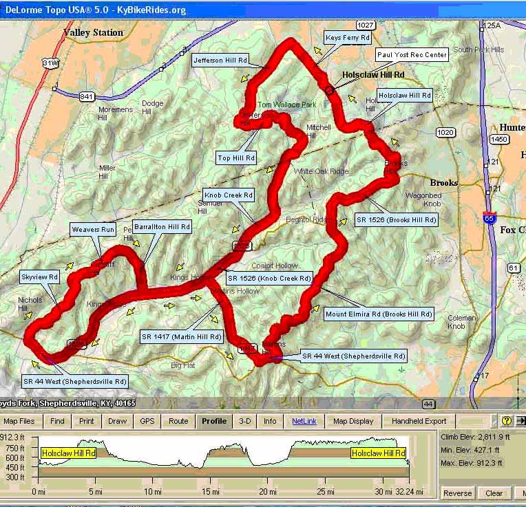
Jefferson County Forest Ride-B |
||
0.3 |
R |
Holscaw Hill Rd |
0.8 |
R |
Mitchell Hill Rd |
1 |
L |
Keys Ferry |
| 2 | L | Jefferson Hill Rd |
4.3 |
L |
Hill Top Rd (Top Hill) |
|
S |
HWY 2672 |
|
S |
HWY 1526 |
14 |
R |
HWY 44 |
| 15 | R | Skyview |
17.2 |
S |
Skyview/Weavers Run |
18.3 |
S |
Barralton Hill Rd |
19.4 |
L |
HWY 1526 |
20.8 |
R |
HWY 1417/Martin Hill Rd |
23 |
L |
HWY 44 |
23.5 |
L |
Mt. Elmira Rd (at edge of Camp) |
27.8 |
R |
HWY 1526 |
29.7 |
L |
Holsclaw Hill Rd |
32.8 |
R |
Paul Yost Recreation Area |
Bold Print indicates long or steep climb
