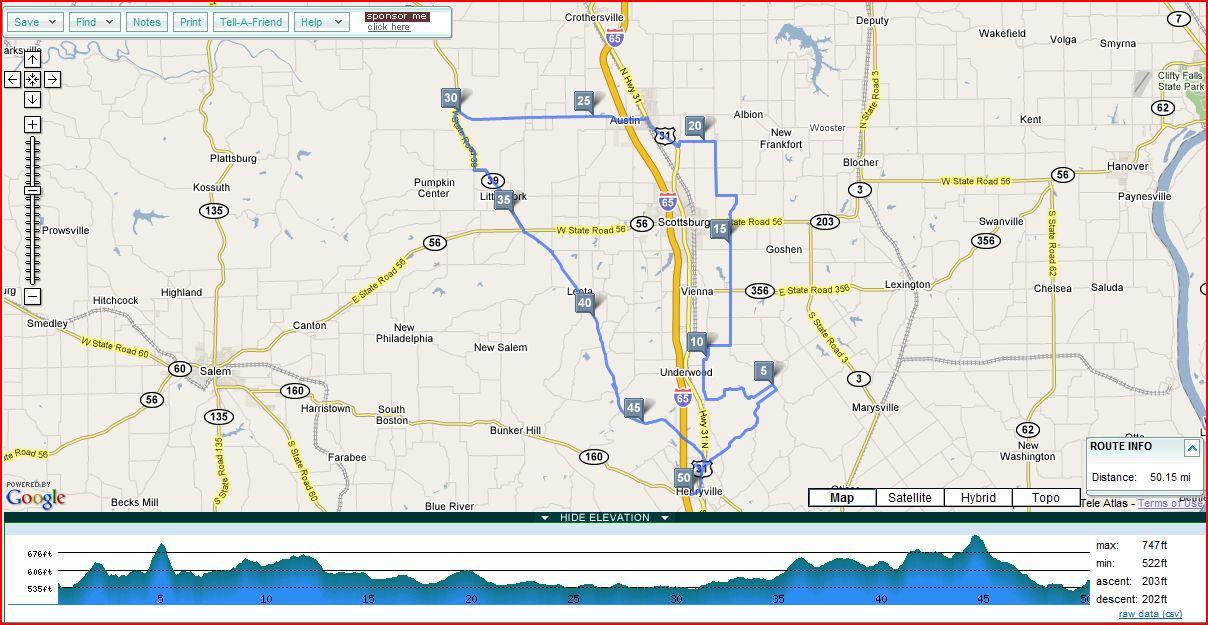
| Clark Forest Loop by Melissa"Puddle" Hall 52.0 mi, |
||
| Miles | Turn | Road |
| 0.0 | L | out of parking lot |
| .6 | L | (1st rd. after cross I-65) |
| .7 | L | New Franke (T) |
| 2 | R | at T toward entrance |
| 2.3 | R | at T |
| 3.8 | L | Hwy. 31 N (SS) |
| 4 | R | Hebron Church Road |
| 8 | L | Beagle Club (no sign, SS. T) |
| 12.1 | R | Halls Corner Road |
| 13.1 | S | Underwood Road (SS) |
| 14.3 | R | Radio Tower Road (SS) |
| 15.1 | L | Double or Nothing (SS) |
| 18.7 | L | Lovers Lane (no sign, SS) |
| 20.3 | S | Becomes Lake Rd. (Traffic lite) |
| 21.3 | R | S. Lake Road (SS) |
| 22.2 | S | Lake Road (Traf. Lite) |
| 23.3 | S | Weir Road |
| 24.1 | R | Boatman (SS) |
| 27.3 | R | Dowling Rd. (SS, no rd. sign) |
| 27.5 | R | Fuel Mart Store Stop |
| L | out of store | |
| 27.6 | R | 256 W (SS) |
| 33.9 | L | 39 (SS) |
| 39.3 | X | 56 (SS) |
| 39.4 | L | Old 56 (Becomes Bloomington Trail) |
| 40.7 | R | Zion Rd. (SS) Becomes Bloom. Tr. |
| 42.5 | Go through Covered bridge and bear right staying on Bloomington Trail | |
| 51.2 | R | on Hwy. 31 South (SS) |
| 51.6 | R | into Forestry |
| 52.0 | L | into Parking Lot |
Click on map below to see scalable Google Style map